
With this guide, it’s possible to walk back through time — thousands of years — and behold a view from above it all.
“Hiking Washington’s History,” out this spring from the University of Washington Press, has the words and maps to guide you on 44 four-dimensional journeys. The book is the gigantic undertaking of Judy Bentley and Craig Romano, two writer-hikers who put in the miles across the state.
Chapter 1: The Olympic Peninsula. This place, “wild in the extreme” as Capt. John Meares said circa 1788, has the first five hikes of the book.
“We’ll visit a coastal village buried by a mudslide and find the Scandinavian footprint on the prairies. We’ll follow expeditions across mountain passes in the late 1800s. Finally, we’ll climb to a World War II lookout post and gaze the same skies on the wide horizon,” the introduction beckons, referring to Cape Alava and Lake Ozette; the Press Expedition route into Olympic National Park; O’Neil Pass, also in the park, and finally Hurricane Hill.
For that 3.2-mile hike, Bentley and Romano set the scene in early 1942. After the Japanese bombing of Pearl Harbor, the U.S. government feared more attacks, with planes flying over the Olympics to hit the Bremerton shipyards or Boeing’s plant in Seattle.
Enter the Aircraft Warning Service, which recruited civilians to live in high mountain lookouts.
“Leith and Mary Johnson had grown up in Dry Creek, west of Port Angeles, and hiked the mountains in their teens. Leith had trained for the signal corps, but developed diabetes and couldn’t enlist. The young couple wanted jobs serving the country.”
The Johnsons became the relief team for Herb and Lois Crisler, who had spent the winter of 1942-‘43 in the Hurricane Hill lookout, a 13-by-13-foot “cabin in the sky.” They’d been snowed in for nine months.
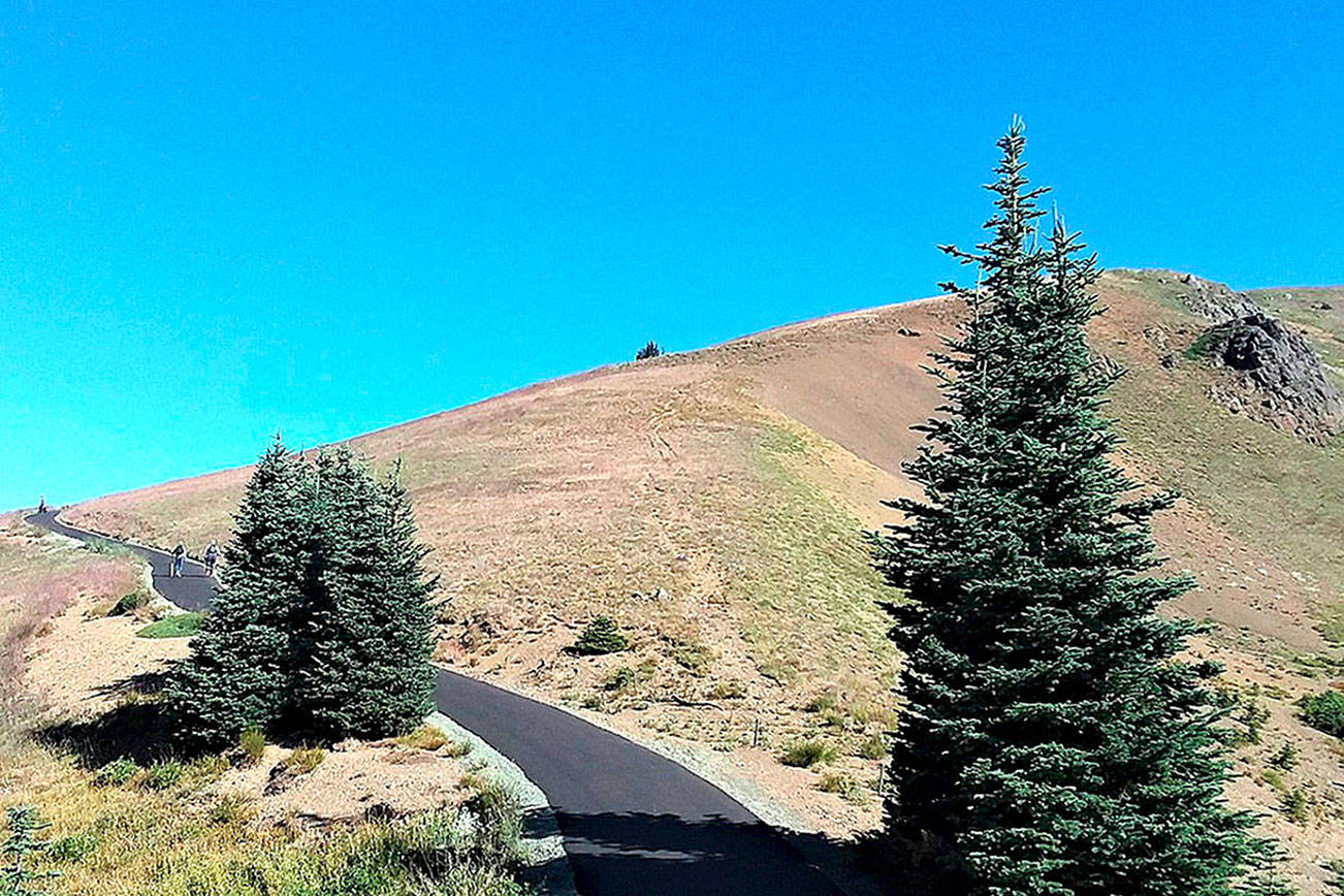
To reach the Hurricane Hill cabin site, you don’t have to hike, like the Johnsons did, 3,800 feet up from the Elwha River valley. Drive to Hurricane Ridge and start hiking at the end of the road, the authors suggest.
At the top, “little is left of the lookout except a concrete footing and rebar, but the sweeping views remain.”
Such vistas attract lots of humans these days, Bentley said in an interview. Still, the Evergreen State offers plenty of solitude elsewhere. One of her favorite paths is Chief Joseph’s Summer Trail, into the high meadows of the Blue Mountains.
Here in southeastern Washington’s Wenaha-Tucannon Wilderness, you can “walk in silence, admire the wildflowers, cool off at the springs, and encounter no one but elk and foxes. It’s no wonder the Nez Perce cherished the land.”
This is the second edition of “Hiking Washington’s History,” and includes a dozen treks that didn’t appear in 2010’s first edition. One is the Yakama Cowlitz Trail — “not one I’d say is the most beautiful spot in the state. But its history is ancient. It’s a 7,000-year-old trail,” added Bentley.
“Native people walked into the mountains every summer to gather berries, hunt, trade and socialize,” the hike description begins.
“The Cowlitz came from the west side and the Yakama from the east side to meet at Cowlitz Pass in the shadow of Mount Rainier. They camped in the meadows beside tarns, ponds and lakes.”
Today this hike is accessible by heading east on U.S. Highway from Packwood or west from Yakima. It’s a 10.4-mile outing with 2,000 feet of elevation gain, so it’s rated moderate.
Yet another kind of experience awaits hikers on Whidbey Island, just across from Port Townsend. Ebey’s Landing is the starting place, not far from the Washington State Ferry dock.
One June day 162 years ago, James G. Swan “left Port Townsend in a canoe and reached here about noon on his way to meet with Skagit chiefs,” the description notes. He set out on foot for Penn Cove, and as he wrote in his journal, “had a most delightful walk.”
These days the Port Townsend-Coupeville ferry transports people to the island, where hikers can head inland on the Ebey’s Prairie Trail, where much of what they see is what Swan did: emerald-green fields rising up from the blue water’s edge.
“The prairie landscape unfolding before you has weathered 6,000 years of human use and still provides crops of beets, corn, alfalfa, cabbage, barley and wheat,” flourishing around a few antique structures. One is the blockhouse Jacob Ebey built in hopes of protecting his family from tribal warriors coming from the north.
Altogether the foray into Ebey’s Landing State Park is a moderate 2.8 miles with a 200-foot gain in elevation. As with each of the hikes in the book, Bentley and Romano suggest nearby sites too: The continuation of the Bluff Trail past the Ebey’s Prairie Trail, for example, takes you to a 260-foot-high point over the sea.
“I hope people will become aware of the trails around them; the local hikes that have lot of history,” Bentley said. Local historical societies, hiking groups and people whose families have lived in a place for generations: Talking with them can make the trail’s past come to life.
“That’s what it’s all about,” she said: “placing yourself in history, and appreciating what all has been here before.”
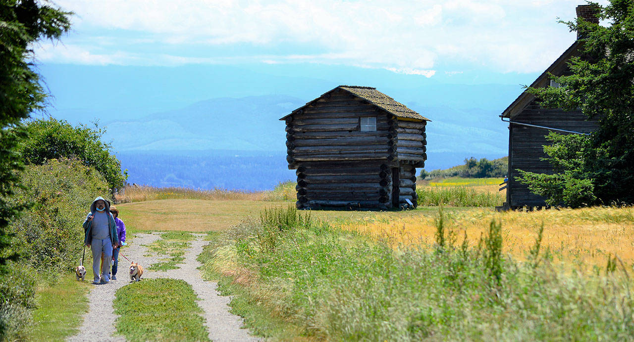
The Ebey’s Landing hike near Coupeville, one of 44 outings in “Hiking Washington’s History,” crosses Ebey’s Prairie to pass the 166-year-old blockhouse built by Jacob Ebey. Photo by Diane Urbani de la Paz/Olympic Peninsula News Group
