Water In Focus: Snowmelt festival?
Published 1:30 am Wednesday, May 10, 2023


Happy Irrigation Week! Or, as a hydrologist might say, “Happy Snowmelt Season!”
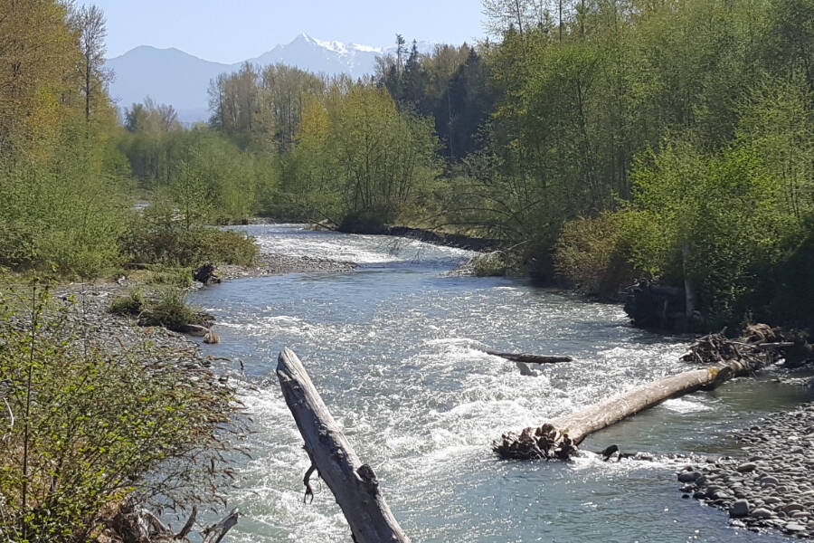
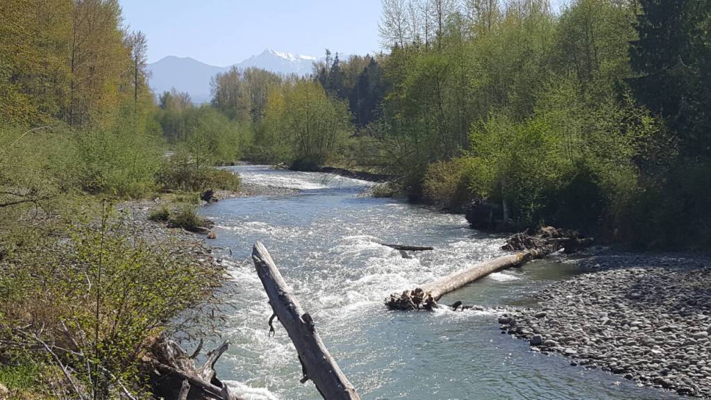
As of the last days of April the Dungeness River is finally running high and strong. Its beautiful milky green tint is from fine-grained minerals in the water called “glacial flour.” This short-lived hue coincides with when we start seeing bare patches of rock in the mountain peaks as the snow cover dissolves — likely dissolving some rock with it.
It was a good year to watch the snow cover repeatedly blanket those peaks: Greywolf Ridge and Blue Mountain, the part of the Olympic Mountains visible from downtown Sequim.
It was also a very interesting year to track the temperature and data on that solid-looking snowpack — and we happen to have a climate monitoring station in the upper Dungeness watershed (a SNOTEL, snow telemetry).
As you might remember, our winter started with a bang as Sequim got a dump of snow right around Halloween. More snowstorms and cold temps followed, and at some point I stopped counting how many mornings we woke to fresh snow on our front deck in the foothills. But those mornings kept coming at our house until late April.
Like everyone, I was plenty tired of scraping thick ice off my car. But, as a hydrologist, I was also happy that measurable snow on our deck meant even more at the SNOTEL station.
Repeated low-elevation snow speaks of our long, cold winter and spring, and the Dungeness snow station is perfectly positioned to tell the story in numbers.
It’s a very local story.
Measuring winter
This winter there were 79 days when the average daily temperature at the Dungeness SNOTEL was below freezing. Last winter, that number was only 57.
In the last days of April, the station’s snow total was around 200 percent of average even though the cumulative precipitation was just average. By contrast, the snow stations in the central and western Olympics reported a dryer winter and snow totals averaged around 75-80 percent of normal.
Why such a big difference?
A few things factor into interpreting Dungeness SNOTEL data. One is its shorter period of record. Most climatological stations use three full decades to establish “normal” values, but the Dungeness only has 23 years of history.
Another key point is where it sits. The station elevation is 4,010 feet — about 3,000 feet below the high peaks.
Plus, the station sits on a ridge above Silver Creek on the eastern side of the large watershed, deep in the rain shadow cast by the central Olympic Mountains.
This location will never record deep snow as found higher up and further west, but the station records every little bit of snow accumulation and melt. And every little bit makes a big difference in terms of comparisons to normal, since it is so common for the Dungeness SNOTEL to report very little or no snow. The median amount for April 30 is 0.0 inches.
Amounting to what?
In 2023, our Dungeness snow station data tell the story of a winter just wet enough and cold enough to accumulate and keep a decent snowpack, at low elevation, in the eastern Olympics, even in late April.
Bill Baccus, an Olympic National Park snowpack expert who skis up to collect data from non-telemetered snow stations, has said about the Dungeness SNOTEL, “At those low elevations, a little snow makes a big difference in percentage [of normal] but how much will it contribute to summer flows?”
We can watch the streamflow data as much as we want all summer but this story’s ending will be written by the weather. By late August we’ll know whether our Dungeness snowpack held up against June and July’s heat and rain.
Then we will have another year of data — and experience — to help predict the future.
Numbers people
Many people living and working in the Dungeness watershed watch very closely the data on snowpack all winter and the hour-by-hour river flow all year.
Some of these people are farmers who depend on snowmelt for irrigation. Some are biologists who know that certain streamflow levels are needed for salmon to thrive at different life stages. Some are water managers who know how critical Dungeness River water is for recharging groundwater aquifers and water storage in general.
Many others are tuned in for the sake of the broader community, human and otherwise. These people are all represented on the Dungeness River Management Team (DRMT), a group of stakeholders working together to solve natural resource issues for more than 30 years.
The DRMT was recently honored with the 2023 “Out Standing in the Field” conservation award from the North Olympic Land Trust. We can all be grateful that team members pay attention to numbers.
Geek moment
To date for the 2023 Water Year (started Oct. 1, 2022):
• At the Dungeness River upper/USGS gage at river mile 11.2, the highest average daily flow was 2,380 cfs on Dec. 27; the low was 75.3 cfs on Oct. 21.
• At the Dungeness SNOTEL station, the max snow depth was 50 inches on March 11 and max snow water equivalent was 16.3 inches in April 5.
Ann Soule is a semi-retired hydrologist immersed in the Dungeness watershed since 1990, reporting water news intermittently. Now she is Resource Advisor for City of Sequim part-time; opinions expressed are hers and do not represent official positions of her employer. Reach her at columnists@sequimgazette.com or via her blog at watercolumnsite.wordpress.com.