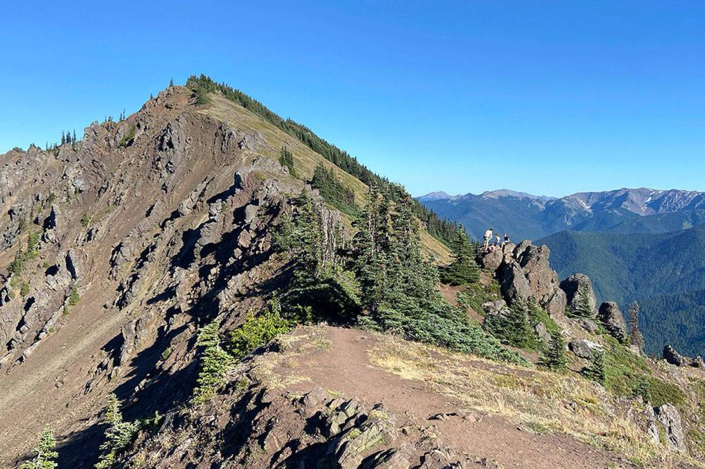
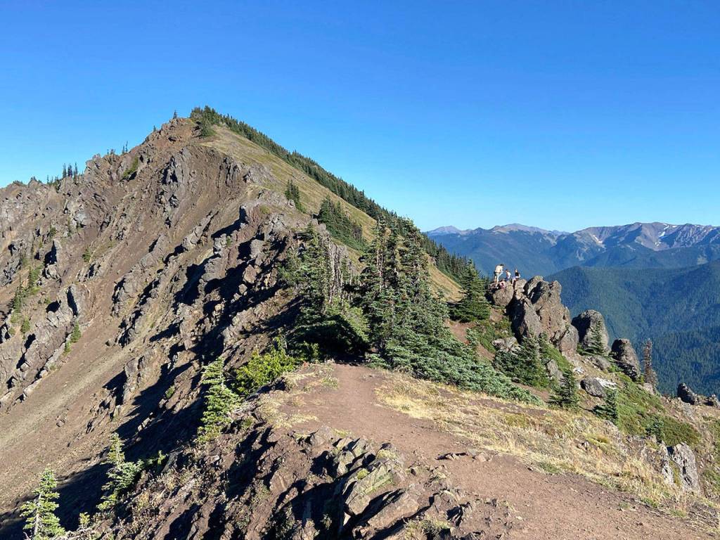
Panoramic views from Klahhane Ridge
Published 1:30 am Wednesday, September 9, 2020
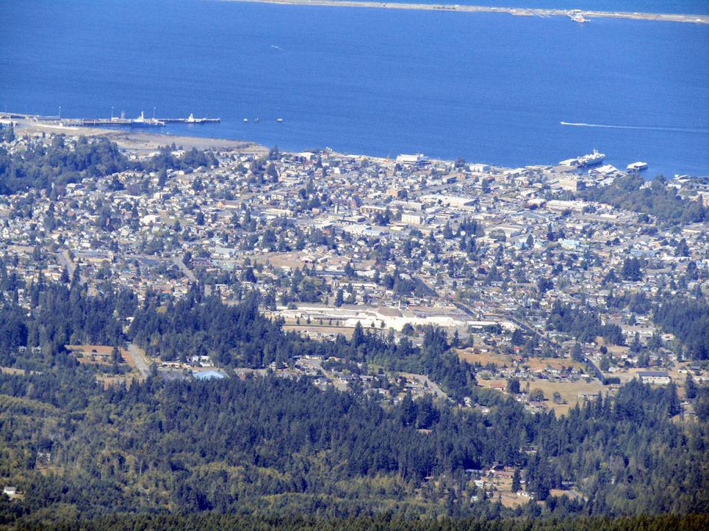


Klahhane Ridge dominates the south horizon of Port Angeles and provides a backyard wilderness experience for many on the North Olympic Peninsula.
Two of the three trails that converge on the 6,000-foot ridge originate at Heart O’ the Hills campground just 7.5 miles from downtown Port Angeles.
Take your pick between the 6.2-mile Heather Park or 6.3-mile Lake Angeles trail and keep going until you reach the top of Switchback trail at a 5,880-foot saddle on Klahhane Ridge.
Follow the opposite trail back to Heart O’ the Hills for a classic 12.5-mile circuit that is both rewarding and convenient for those in the Port Angeles-Sequim area.
A clear day on Klahhane Ridge offers views of the Olympic Mountains, North Cascades, and the cities and towns of the North Olympic Peninsula and Vancouver Island.
The ridge is largely composed of basalt bedrock of the Crescent Formation, part of the humongous Siletzia terrain that formed offshore and slammed into the North American continent about 51 million years ago, according to geologists.
Klahhane Ridge is anchored by 6,454-foot Mount Angeles on the west and 6,218-foot Rocky Peak on the east, both of which require a rock climb.
The Heather Park-Lake Angeles loop encircles the upper Ennis Creek basin on the north face of Klahhane Ridge and reaches a high point of 6,050 feet.
Both trails head south from Heart O’ the Hills under a forest canopy and climb moderately on long switchbacks. It’s a 4-mile trek to 5,250-foot Heather Park, a sub-alpine bowl with campsites, and 3.4 miles to lovely Lake Angeles at 4,275 feet.
The 2.2-mile alpine section from Heather Park to Switchback trail is the most challenging of the loop because of loose scree and steep slopes. That leg was devoid of other hikers last Friday afternoon, a rarity on most trails this summer.
Switchback trail, by far the most popular route to Klahhane Ridge, begins at a 4,400-foot trailhead along Hurricane Ridge Road on the south face of the ridge. It climbs 1,480 feet in just 1.6 miles.
Another trail — a 2.8-mile ridge line route from the Hurricane Ridge Visitor Center — connects to Switchback trail about one-third of the way up.
The Heather Park-Lake Angeles loop remains a personal favorite because of its varying scenery and relative solitude, especially on the Heather Park approach.
It’s also nice when the drive to the trail is shorter than the hike itself.