Sequim: Watch your shelf (cloud)
Published 1:30 am Wednesday, October 4, 2017
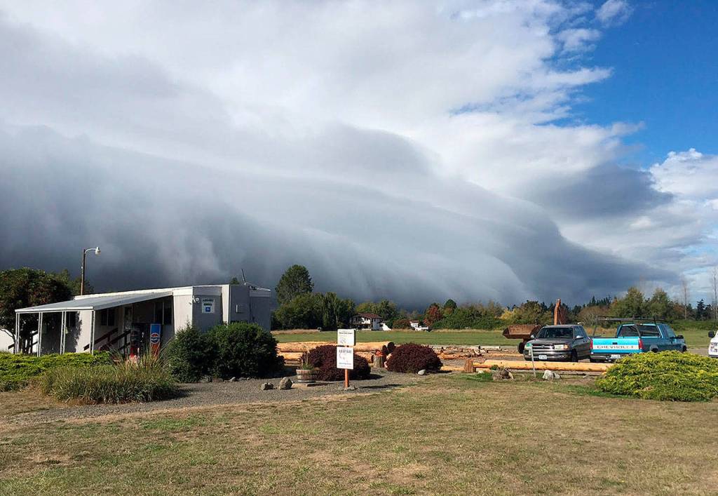
Contributor Andy Sallee caught this scene of a “shelf cloud” at about 2 p.m. Sept. 29 at the Sequim Valley Airport.
A heavy rain cell creates the cloud when downdrafts spread out from intense rain showers, said KOMO News meteorologist Scott Sistek. As the cool wind races outward from the cell’s center, he said, it pushes into the warmer air surrounding the cloud, creating lift and a visible line of clouds.
Sistek, whose parents live in Port Angeles, wrote about the “shelf cloud” pair with Sallee’s photos on his blog at komonews.com.
For those watching the clouds on the ground, Sistek said, that it’s a signal of a strong downdraft and is spreading along the surface, and that a wall of wind is on its way.
“That was true in this case as around the time these photos were taken,” Sistek wrote.
“My dad had called from Port Angeles and said a wall of wind had just struck out of nowhere. His weather station measured a gust of 32 knots where the winds had been essentially calm before.”
See photos of the weather anomaly here.



Best of Olympic Peninsula