
In June 1977, I left Seyðisfjörður, a town of 900 people at the end of a fjord on the east coast of Iceland. With Geoff Hunter, I hoped to kayak 1,500 miles, to circumnavigate the island. I looked up at the snow-covered mountains and felt a chill of apprehension.
The long punishing ferry journey, north from the UK, had emphasized how powerful the north-Atlantic swell could get. Paddling clockwise around Iceland, we would soon reach the most exposed section, the sands of the south coast, and that made me uneasy.
A letter from the Icelandic coastguard, helpfully addressing my initial enquiries, brusquely dismissed that stretch of coast. He took it for granted we would heed his warnings that conditions there would be prohibitive.
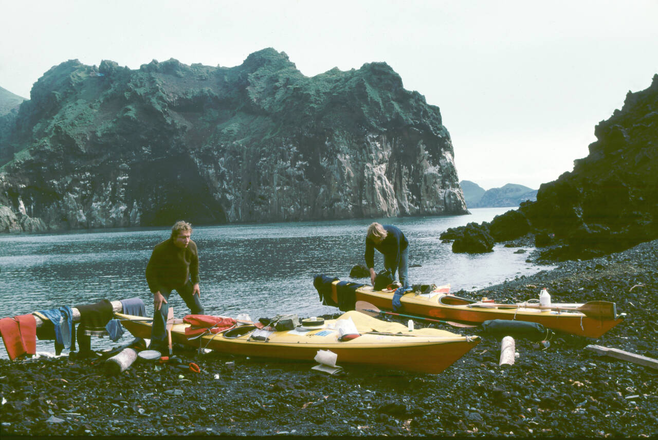
PhotoS courtesy of Nigel Foster Nigel Foster on Flatey Island.
With heavy surf pounding steep beaches, sandstorms, quicksand, no habitation, there would be nothing but bare sand on which to camp.
He wrongly assumed we would avoid that folly.
State of art, 1970s style
The Vyneck kayaks we used were of my own design. They were fast, straight tracking and tippy. There being no dry-suits then, I wore fleece beneath my state-of-the-art kayaking anorak. Neither the anorak hood nor its elasticated wrists did much to slow the chill ingress of water.
I planned to detour to buy food at villages along the way, a few days’ supply at a time. That did not always pan out. High winds frequently stopped us for days on end. But we were resourceful. Seagull curry, Geoff?
Hitting the south coast sands
The south coast humbled us. Geoff was flung end over end trying to penetrate the surf. In our tent, sand forced its way into everything we had, all our food, our clothes, our eyes.
Inside my camera, it scratched the film. But there was a wild beauty about the vast black sand stretching to the horizon. Logs, sandblasted and silvered, lay scattered far inland. Glass fishing floats from the size of a grapefruit to the size of a football, seemed to glow on the sand.
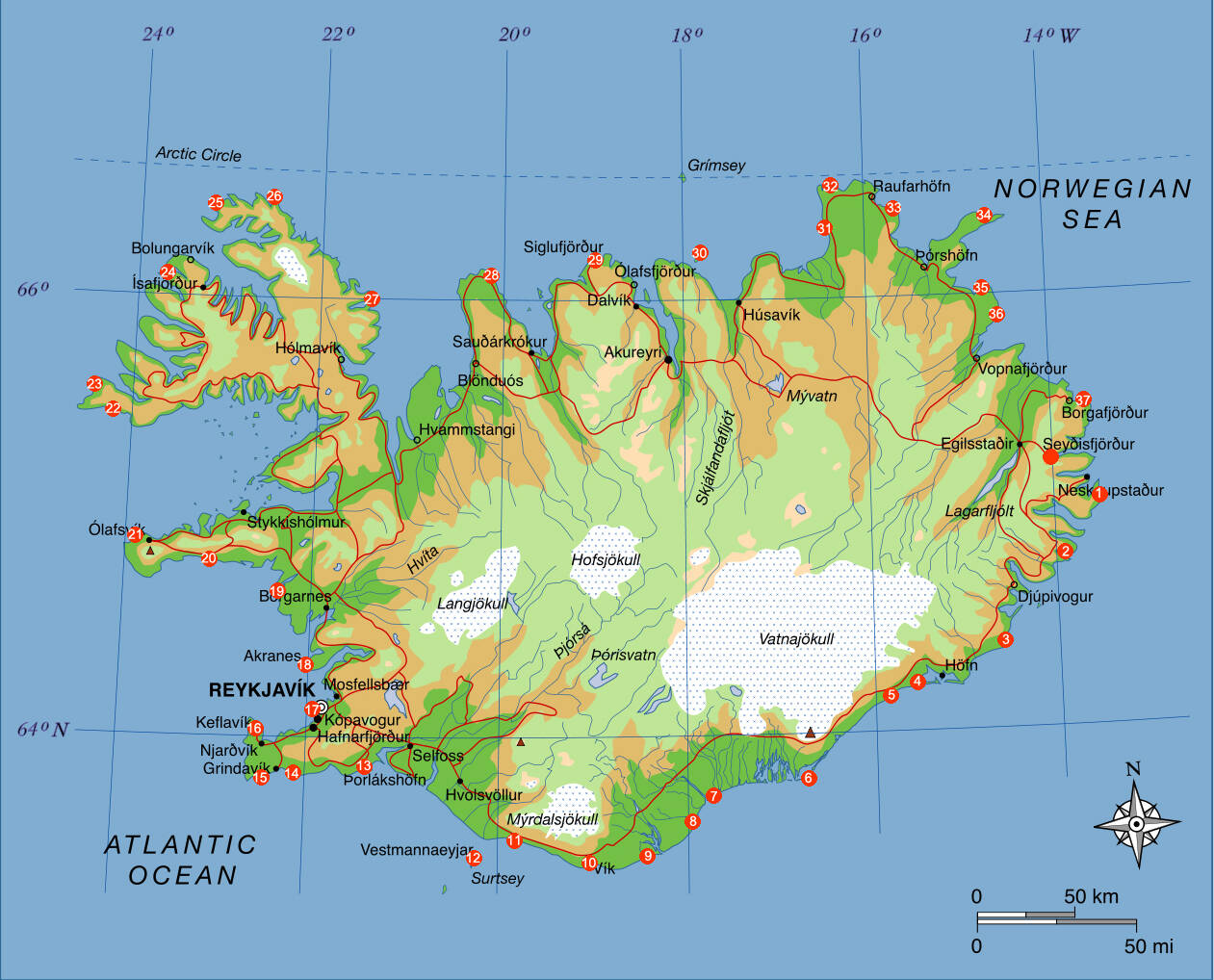
Map courtesy of Nigel Foster / Iceland map, with Nigel Foster’s 1977 trip marked.
With nothing against which to judge scale and distance, we mistook a whale bone for a shipwreck shelter. Low on food, could we wade the eight miles inland to the nearest farm road, leading to Iceland’s newly completed (gravel, not hard-top) ring-road?
Iceland’s volcanic legacy
With huge relief we reached towering cliffs again, the air alive with the wing-beats of millions of seabirds. Looking at the map I gauged our progress and planned our strategy.
If all went well, we would soon reach the Westmann Islands, on the mid-Atlantic ridge where Eldfell had erupted just four years earlier to engulf half the town. Only part-way into our journey, we already knew we could take nothing for granted.
Success
So, did we make it all the way around Iceland? Yes, and in time to catch the August ferry home.

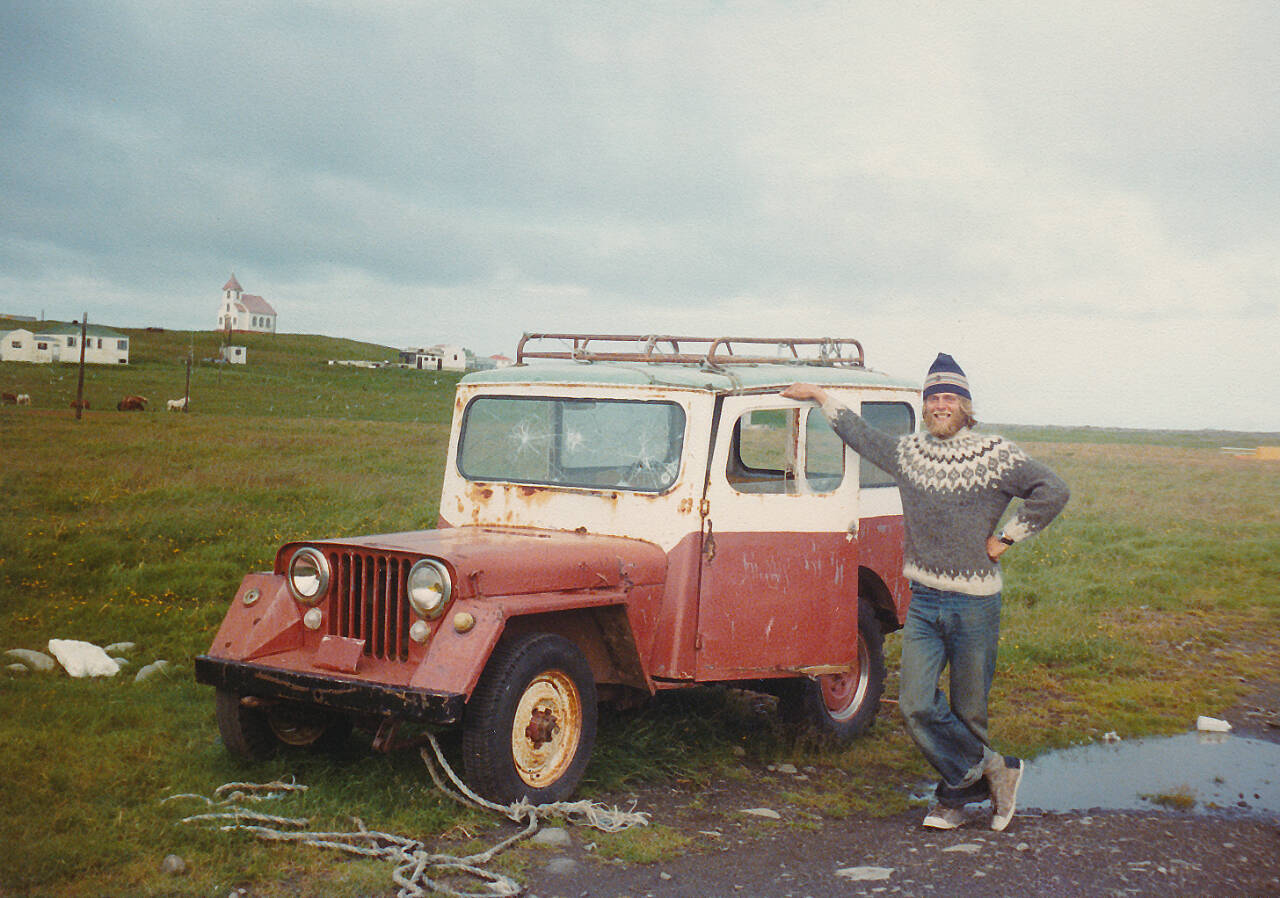
Photo courtesy of Nigel Foster / Geoff Hunter with Axel in northwest Iceland.
I left feeling a mixture of pride and disappointment. I had so enjoyed the experience, meeting Icelandic people, trying to guess what the weather might throw at us, watching the seabirds, seals, dolphins, and whales, and camping in wild places. I wished the trip had lasted longer, but after such a rich experience I had plenty to recall.
In any case, at 24 years old, the world awaited.
Creating the book
With my trip-planning notes, and the journal I kept throughout the trip, I had a foundation on which to structure my book: Iceland by Kayak, newly published. I loved revisiting the experiences, remembering how it was to plan and complete a trip before home computers, long before Google.
Now we have cellphones, handheld waterproof VHF radios, GPS, digital cameras, even digital music and digital books. Travel experiences are inevitably different.
Despite that, happily, every adventure is still an adventure.
About the presenter
Nigel Foster is an internationally renowned sea kayaker. When introduced to kayaking as a teenager, he became hooked on surf kayaking. He enjoyed whitewater, sea kayaking, and open canoe too, but became known for his sea kayaking expeditions, which provided material for magazine articles and books.
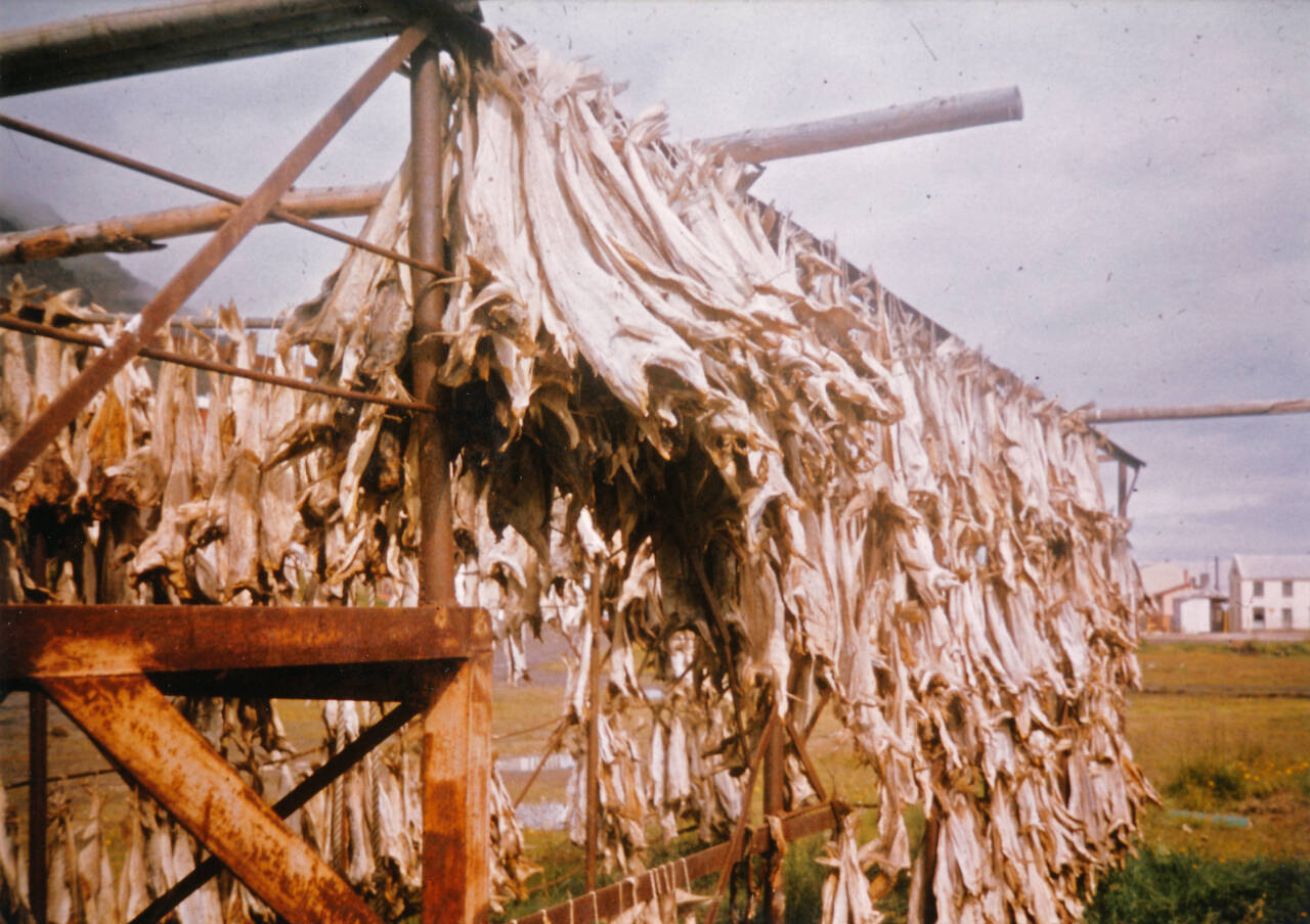
Photo courtesy of Nigel Foster Fish drying in east Iceland.
Having trained as a teacher, Foster taught in Outdoor Education Centers before branching out to make his living instructing and guiding around the world. He also designs kayaks and kayaking equipment, most recently for Point65 Sweden.
Having written and published more than a dozen technical and travel books, in addition to countless magazine articles, his latest book is “Iceland by Kayak.”
Foster lives in Seattle with his wife, ceramic artist Kristin Nelson of KriKri Studio. When he is not kayaking, he enjoys spinning around in a little red canoe, and playing guitar, but not at the same time.
Check him out on Wikipedia or at nigelkayaks.com.
About the series
Traveler’s Journal, a presentation of the Peninsula Trails Coalition, raises funds to buy project supplies and food for volunteers working on Olympic Discovery Trail projects. Shows start at 7 p.m. at the Dungeness River Nature Center, 1943 W. Hendrickson Road.
Admission is a suggested donation is $5 for adults. Attendees are encouraged, but not required, to wear mask.
For more information, email Arvo Johnson at amjcgj@gmail.com.
2024 Traveler’s Journal Series
When: 7 p.m., Thursday, Feb. 29 (door opens at 6:30 p.m.)
Presenter: Nigel Foster
Presentation: “Iceland by Kayak, the first circumnavigation”
Where: Dungeness River Nature Center, 1943 W. Hendrickson Road
Cost: Suggested $5 donation (adults)
Coming up: “700 miles of canoeing, by bike” with Jeff and Louise Davis, March 7
